Silent Hiking in China—SANCTUM LOST
Echophotograph
0:00 / 0:00
Silent Hiking in China—SANCTUM LOST
87 просмотров · 13 дн. назад
Echophotograph
7 подписчиков
87 просмотров · 13 дн. назад
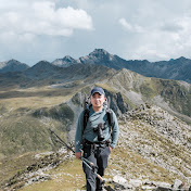
Solo, five days and four nights, carrying all my gear, traversing the Bogda C Route.
The name “Bogda” comes from Mongolian, meaning “god,” “sacred mountain,” or “dwelling place of the gods.” Ancient nomadic peoples of the Western Regions had a tradition of worshipping famous mountains. Because Bogda Mountain was tall and precipitous, it was revered as a “sacred mountain” and “ancestral peak.” Riders dismounted when they saw it, travelers bowed, and officials stopped their carriages to pay respects.
After the Yuan Dynasty, Taoist mythological elements were added to Bogda Peak. In 1219, Taoist master Qiu Chuji, traveling west at the summons of Genghis Khan, passed through this area and wrote the poem “Staying at Luntai and Gazing Southeast at the Yin Mountains.” Taoist texts regard the Bogda Mountains as the dwelling place of the Queen Mother of the West.
In the Qing Dynasty, Bogda was formally incorporated into state sacrifices. In the 24th year of Qianlong (1759), the Qing government sent the minister stationed in Urumqi to Bogda Mountain to offer sacrifices and issued the “Bogda Ola Sacrificial Text.” From then on, the government organized large-scale public sacrifices every year, with a status equal to that of the Five Great Mountains. It was honored as “Fushou Mountain” (Mountain of Fortune and Longevity). This official sacrificial tradition continued into the Republic of China period.
The trekking route starts at the Aksu River Valley and passes the Aksu Glacier, Tiger’s Mouth, East Gully Glacier, Zhuanshan Daban, West Gully Glacier, Jiandan Daban, Sigong Glacier, Suishi Daban (Gravel Pass), and No. 4 Sheepfold, before exiting the mountains from Sankeshan Village.
The Bogda C Route is like Death Stranding: there is no Timefall, but there are glacial meltwater rivers and rockfall; there are no BTs, but there is hypothermia and slipping or falling.
Beneath the snow mountains, glaciers, and high passes, every step requires weighing stamina against risk. There are no save points. Spectacular scenery and danger coexist.
If you’d like to know more about this route or have any filming-related questions, let me know in the comments. You’re also welcome to share this video with more people.
Camera: SONY A7C2 + FE 16-35mm F2.8 GM II + SIGMA 20-200mm F3.5-6.3 DG + ECM-M1
Drone: DJI Mini 5 Pro
