Takakkaw Peak, Yoho National Park, BC - July 18th 2026
Annie Ouellet
0:00 / 0:00
Takakkaw Peak, Yoho National Park, BC - July 18th 2026
336 просмотров · 1 день назад
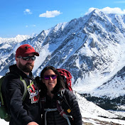
Annie Ouellet
646 подписчиков
336 просмотров · 1 день назад
Trail : Takakkaw Peak (from
Takakkaw falls
Date : July 18th 2026
Location : Yoho National park, BC
Trailhead location : Takakkaw falls dayuse area, at the end of Yoho Valley road near Field
Starting time : 5h31 am
Time to the False summit (about 300 m from summit) : 5h30
Total time : 9h37
Distance : 17km (8 km on flat by Yoho River to and from Angel Staircase)
Elevation gain : 1650
Difficulty: Very hard hike with Moderate to hard scramble
Trail traffic : We were the only crazy ones there!
Park Pass needed : Free till Sept 2026
Knowing it would be a long day, we camped just outside Yoho National Park and set our alarm for 4:00 a.m., starting from the Takakkaw Falls day-use area at 5:30 a.m. From there, you hike to the falls and follow the Yoho River until you reach the Angel Staircase. There is some bushwhacking during these first 4 kilometers. We noticed a trail on our map that appeared to head directly up toward Takakkaw Lake after roughly 2 kilometers, but since I hadn’t researched that route, we stuck with the Angel Staircase.
There was A LOT of water. We started climbing the staircase but quickly decided it would be safer to make our way up through the forest on the left. If the staircase is called “Angel,” then that forest bushwhack was HELL! We were both wearing shorts… 🫠 Our legs now look like we were attacked by a cougar. 🤦🏻♀️ Some sections honestly felt just as sketchy as the staircase itself. At times, we were right above the waterfall’s edge. A slip would have sent us over a high cliff, so we had to be extremely cautious. If you’re looking for a trail… there isn’t one. It’s pure bushwhacking. In fact, this entire hike and scramble has absolutely NO trail.
Once above the falls, we entered a beautiful alpine valley. It is absolutely gorgeous up there. But you still need to climb much higher before the incredible glacier, lake, and tarn views really begin to appear. At this point, you’d probably think the peak above and to the left is Takakkaw Peak, but it isn’t, you still can’t see the true summit because it’s hidden behind it.
We also thought the logical route would be to head right and gain the ridge above Takakkaw Lake, which certainly looked easier but that’s not the route to Takakkaw Peak and it would add a fair amount of distance. Instead… you head straight up and then angle left after leaving the staircase. Steve and I just looked at each other like… “WTF… that’s the route?!” Yep… that’s the route! So up we went. It was steep, loose, and relentless, although we’d seen this type of terrain before. The entire ascent above the staircase is incredibly LOOSE. Even the big rocks are loose.
Once you reach the ridge, the scenery becomes absolutely breathtaking. Glaciers, tarns, waterfalls cascading down from the Iceline Trail… it is simply spectacular. Descending from the ridge to Takakkaw Lake would actually make for a fantastic objective on its own and involves far less scrambling than continuing to Takakkaw Peak.
But we were there for the summit, so onward we went.
From the ridge, we put our helmets on and scrambled toward the peak. Thankfully, this section was completely snow-free. There were a few small glaciers along the way, but we never had to cross them, we simply admired them. The scrambling was moderate but on loose rock… which is definitely not my favourite. More than once, we thought we’d reached the summit, only to discover yet another high point farther ahead.
Eventually, we reached a point that became our summit for the day. The true summit was only about 300 metres farther, but that final section consisted of a narrow, exposed ridge with unstable terrain and massive drop-offs on both sides. We had already climbed over 1,600 metres, so we were incredibly high up. Although we’ve probably done more difficult sections before, I simply wasn’t comfortable with that last stretch. In my opinion, it wasn’t worth the risk. We were already enjoying the exact same incredible views. It’s always disappointing not to reach the true summit because I’m not someone who likes to give up, but I also wanted to make it back home safely.
Those who continue to the summit can actually complete a loop by descending along the East slope of the peak. But there was still far too much snow and several huge cornices on that side, so it wouldn’t have been an option for us anyway.
I also couldn’t stop thinking about our descent and the steep downhill bushwhacking that was waiting for us. I was already exhausted and sore just thinking about it. 🤣
We enjoyed lunch overlooking Takakkaw Lake, Mount Niles, and the Daly Glacier. Honestly, it felt like eating in paradise. WHAT. A. VIEW.
The descent went exactly as expected… HELL. 🤣 We were beyond happy to finally regain the Yoho River and walk alongside it back toward Takakkaw Falls.
