Big Mesa Trail | Navajo Rocks MTB in Moab, Utah | 4K POV
Endless Singletrack
0:00 / 0:00
Big Mesa Trail | Navajo Rocks MTB in Moab, Utah | 4K POV
167 просмотров · 2 нед. назад
Endless Singletrack
43 подписчика
167 просмотров · 2 нед. назад
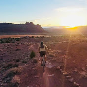
Ride the complete Big Mesa Trail at Navajo Rocks near Moab, Utah in immersive 4K POV.
Big Mesa was the fifth and final trail of my clockwise ride around the full Navajo Rocks loop. After completing Ramblin’, Rocky Tops, Coney Island, and Big Lonely, this predominantly descending segment carries the ride beneath the massive Lone Mesa and eventually back toward the Ramblin’ Trailhead.
The defining feature of Big Mesa for me was Lone Mesa itself. I knew beforehand that the route would eventually take me alongside it, but I was still surprised by how unique the landscape looked and felt once I actually reached the base of the mesa.
The trail combines classic Moab desert singletrack with slickrock, including interesting sidehill sections that traverse the sloping sandstone beneath Lone Mesa. With the majority of the climbing already behind you when riding the loop clockwise, Big Mesa also provides a satisfying final stretch toward the completion of the full 18-mile ride.
CHAPTERS
0:00 Big Mesa stars at Dubinkey Well Road at the end of Big Lonely Singletrack.
4:26 Riding North – East towards ‘Lone Mesa’ ( The ‘Big Mesa’ the trail name is referring to.)
8:42 Junction of ‘ Wipe-Out Hill’ Jeep Route. Go straight to continue on the singletrack!
9:00 The character of the trail changes here. The terrain is unique as you skirt the base of ‘Lone Mesa’
11:51 Slickrock sidehill section.
13:13 Steepest slickrock uphill section.
15:19 The giant cliffs are impressive to ride under!
17:45 Bridge
20:14 Giant alcove in the sheer cliffside.
21:17 Cross over the jeep road to continue on the single track.
24:26 Turn right and follow the blue dashed line back to the parking lot. The red dashed line is ‘Ramblin’ trail.
RIDE INFO
Trail: Big Mesa
Trail System: Navajo Rocks
Difficulty: Intermediate
Direction Ridden: Clockwise-loop direction
Video/Riding Time: ~26 minutes
Length: 3.3miles
Terrain: Slickrock, dirt, rock & desert singletrack
Location: Moab, Utah
Filmed: September 22, 2026
WHAT TO EXPECT
When ridden as the final section of the clockwise Navajo Rocks loop, Big Mesa generally trends downhill toward the trailhead.
Expect intermediate desert singletrack mixed with slickrock and rocky terrain. One of the trail's most distinctive sections follows the base of Lone Mesa, where portions of the route traverse sloping sidehill slickrock beneath the enormous sandstone formation.
The terrain remains engaging without becoming excessively technical, making Big Mesa an enjoyable conclusion to a longer intermediate ride.
For me, the combination of descending terrain, unusual slickrock riding, and the scale of Lone Mesa gave this final section a completely different character from the panoramic terrain of Big Lonely immediately before it.
PART OF THE FULL NAVAJO ROCKS LOOP
I rode Big Mesa as the fifth and final trail making up my 18-mile clockwise Navajo Rocks ride:
Ramblin’ → Rocky Tops → Coney Island → Big Lonely → Big Mesa
The complete ride totaled 18 miles with 1,661 feet of elevation gain and 2 hours 34 minutes of moving time.
The clockwise route begins with the playful, generally descending Ramblin’, climbs through Rocky Tops and Coney Island, reaches expansive views on Big Lonely, and then finishes beneath Lone Mesa on Big Mesa.
Together, the five trails create a varied intermediate ride through slickrock, desert singletrack, canyon country, exposed viewpoints, and some of the distinctive sandstone landscapes surrounding Moab.
ABOUT THIS VIDEO
Filmed from a full-face helmet chin mount with a GoPro HERO13 Black in 4K/30fps Ultra Wide with stabilization and the Media Mod.
The video uses primarily natural trail and bike audio for an immersive rider-perspective experience, with music limited to the beginning and end.
This video is part of Endless SingleTrack—full-length mountain bike rides created for trail research, trip planning, entertainment, virtual riding, and experiencing the landscapes of southeast Utah.
Ride within your ability, carry adequate water and supplies, and check current trail and weather conditions before heading out.
