Riding ALL of Porcupine Rim | Epic Moab MTB in 4K POV
Endless Singletrack
0:00 / 0:00
Riding ALL of Porcupine Rim | Epic Moab MTB in 4K POV
184 просмотра · 4 дн. назад
Endless Singletrack
46 подписчиков
184 просмотра · 4 дн. назад
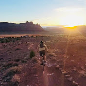
Experience 21.4 miles of Moab mountain biking in continuous 4K POV, from the Kokopelli Trail climb through Upper Porcupine Singletrack (UPS), Lower Porcupine Singletrack (LPS), and Porcupine Rim, finishing along the Colorado River at Lion’s Park.
This advanced ride combines a steep opening climb, rugged rocky singletrack, technical ledges and stair-step descents, optional drops, and spectacular views toward Castle Valley. I took the Snotch route on LPS, walking the Snotch itself. The final descent into the river corridor features steep technical terrain and exposed sections.
ROUTE & RIDE STATS
Route: Sand Flats Road / Kokopelli Trail junction → Kokopelli climb → UPS → LPS (Snotch route) → Porcupine Rim → River Road → Lion’s Park
Distance: 21.4 miles
Elevation gain: 1,079 ft
Elevation descent: 4,455 ft
Moving time: 2:12:48
Total elapsed time: 2:45:35
Difficulty: Advanced
Filmed: October 26, 2026 | Midday | Partly cloudy to clear, temperatures in the 60s °F
Video: GoPro HERO13 Black | 4K / 60 fps | Ultra Wide | Continuous POV
CHAPTERS:
0:00 Preview
1:04 Route Info
1:12 Flyover Animation
1:58 Start, end, and shuttle tips
3:00 Kokopelli Segment Start
3:26 Steep grades to start
20:39 Left turn onto 'UPS' (Upper Porcupine Singletrack)
33:12 Steep slickrock to flowy singletrack
34:00 Start of 'LPS' (Lower Porcupine Singletrack)
40:20 Keep right to stay on 'LPS' at this junction (left goes to 'Eagle Eye')
42:25 Keep left to go to 'The Notch' or stay right to go down 'The Snotch' route. You may have to walk them because they are steep and exposed.
44:23 'The Notch'
52:50 Overlooking Castle Valley
57:37 LPS ends and merges into Porcupine Rim 4x4 here. Stay right to continue on route.
1:02:45 Fun stair-step section
1:09:05 Early on in the 4x4 section there are some hills like this.
1:11:19 Technical uphill
1:12:35 very few uphills from here on out
1:21:27 Rock garden
1:34:48 This section has many optional cliff jumps
1:39:39 stair-step
1:42:12 Singletrack again! Start of final descent
1:43:25 Another speedy section
1:47:17 Difficult technical feature
1:50:02 Steep and rocky! should have stayed right here
1:52:44 Steep and rocky!
1:56:17 Stairstep to catch some air!
1:58:30 Steep exposed technical rocky feature
1:58:54 Difficult rock to bike up. You will likely have to walk
2:00:23 Narrow exposed stairstep
2:02:37 End of Porcupine Rim route
2:03:53 construction
2:07:26 Back on bike path
2:16:24 Matrimony Springs
2:17:22 Lions Park
2:18:00 Outro
TRAIL NOTES
Porcupine Rim is a challenging, remote ride with sustained rocky terrain, technical line choices, exposed sections, and a long exit if something goes wrong. A shuttle or self-shuttle makes the logistics easier; I paid approximately $50 after tax for my shuttle on this date. There are several possible starting points, so check the exact route before you go. Recent rain had left puddles on UPS and affected shuttle access higher on Kokopelli.
Bring adequate water, food, tools, and protective gear; check weather and trail conditions; study the route; and scout obstacles when needed. Spring and fall often offer more comfortable temperatures than summer. Ride within your ability and respect trail conditions.
Endless SingleTrack documents complete mountain bike rides around Moab, Utah—so you can explore the trail from home, preview the route before riding, or simply enjoy the scenery.
Subscribe for more immersive Moab MTB trail rides in 4K POV.
#PorcupineRim #MoabMTB #MountainBiking
