The largest earthquakes since 1900, explained
Restless Planet
0:00 / 0:00
The largest earthquakes since 1900, explained
12 просмотров · 10 дней назад
Restless Planet
28 подписчиков
12 просмотров · 10 дней назад
Get the 10-year earthquake map as a printable poster: https://www.etsy.com/listing/45987985...
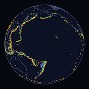
Since 1900, Earth has recorded 100 earthquakes of magnitude 8 or more. Five of them released more than half of that catalog's seismic energy.
Using the U.S. Geological Survey's ANSS ComCat catalog (M8.0+, Jan 1, 1900 to Dec 31, 2025 UTC), we map every giant, show how the five M9+ events dominate the energy budget, measure rupture footprints with USGS finite-fault models and aftershocks for the 2004 Sumatra and 2011 Tohoku earthquakes, and explain why megathrust slip can displace the seafloor and launch ocean-crossing tsunamis. Decade counts range from 4 (1980s) to 13 (2000s), averaging 8 per decade from 1900 through 2019.
CHAPTERS
0:00 Intro: 100 giants since 1900
0:29 A century of giants
1:08 Most of the energy is in five quakes
2:13 Why megathrusts get so big
3:28 How far a rupture can run
4:42 The five magnitude nines
5:40 When the seafloor jumps
6:41 No schedule
7:29 Reading the century
SOURCES
Earthquake data: U.S. Geological Survey, ANSS Comprehensive Catalog (ComCat), M8.0+ worldwide, 1900-01-01 to 2026-01-01 UTC, public domain. Retrieved Oct 12, 2026. https://earthquake.usgs.gov/earthquak...
USGS, 20 Largest Earthquakes in the World (Chile 1960 M9.5 ranked #1). Retrieved Oct 15, 2026. https://www.usgs.gov/programs/earthqu...
USGS FAQ, Where do earthquakes occur? (circum-Pacific belt ~81%; subduction). Retrieved Oct 15, 2026. https://www.usgs.gov/faqs/where-do-ea...
USGS, Earthquake Magnitude, Energy Release, and Shaking Intensity (~32× energy per magnitude step; ~10× amplitude). Retrieved Oct 15, 2026. https://www.usgs.gov/programs/earthqu...
USGS, This Dynamic Earth: Understanding plate motions (subduction zones). Retrieved Oct 15, 2026. https://pubs.usgs.gov/gip/dynamic/und...
USGS finite-fault product for 2004 Sumatra–Andaman (official20041226005853450_30); N–S extent of FFM patches ~1,500 km. Retrieved Oct 15, 2026.
USGS finite-fault product for 2011 Tohoku (model-length 625 km). Retrieved Oct 15, 2026.
USGS ComCat aftershocks: M5+ within 30 days of 2004-12-26 in the Sumatra–Andaman region (312 events) and of 2011-03-11 off Honshu (567 events). Retrieved Oct 15, 2026.
U.S. Tsunami Warning Centers / weather.gov JetStream tsunami FAQ (sudden ocean displacement; vertical seafloor motion). Retrieved Oct 15, 2026. https://www.tsunami.gov/ and https://www.weather.gov/jetstream/tsu...
Basemap: Made with Natural Earth, 1:50m land (public domain). https://www.naturalearthdata.com
Method: Energy shares use relative scaling E ∝ 10^(1.5 M) (and a cross-check with log E = 5.24 + 1.44 M); both put the five M9+ events above half of catalog energy and Chile 1960 near a quarter. Offshore/ocean-margin = all catalog events except five inland Asian ruptures (1905 Mongolia, 1911 Kyrgyzstan, 1934 Bihar–Nepal, 1950 Assam–Tibet, 1957 Gobi-Altay); Makran 1945 is counted as ocean-margin subduction. Sumatra rupture length is the N–S geographic span of USGS FFM patches (~1,500 km); Tohoku length is the USGS finite-fault model-length property (625 km). Decade bars are calendar decades in UTC; 2020s cover 2020–2025 only. Megathrust diagram is schematic, not to scale. No death tolls or damage imagery.
Music: none. Fonts: Montserrat and Inter (SIL Open Font License).
Narration: AI-generated voice. Maps, animation and analysis: Restless Planet.
More earthquake videos: • Earthquakes
More Earth-science map posters: https://www.etsy.com/shop/RestlessPla...
#RestlessPlanet #earthquake #megathrust #earthscience
New maps every Tuesday and Friday. Subscribe: / @restlessplanetearth
