Every earthquake of the last 10 years: why the Ring of Fire exists
Restless Planet
0:00 / 0:00
Every earthquake of the last 10 years: why the Ring of Fire exists
12 просмотров · 12 дней назад
Restless Planet
27 подписчиков
12 просмотров · 12 дней назад
Get this map as a printable poster: https://www.etsy.com/listing/45987985...
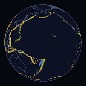
We mapped all 74,785 magnitude 4.5+ earthquakes of the last ten years. Here's what the pattern tells us about how our planet works.
Using the U.S. Geological Survey's global catalog (Oct 1, 2016 to Sep 30, 2026, UTC), we show how often earthquakes happen, why a handful of giants release most of the energy, and how plate boundaries, above all the subduction zones around the Pacific, explain the map. We also test the USGS figure that about 81% of the planet's largest earthquakes strike the Ring of Fire: in our decade, 106 of the 133 magnitude 7+ earthquakes (80%) were on the Pacific rim.
CHAPTERS
0:00 Intro: 74,785 earthquakes on one map
0:32 A decade of earthquakes
1:27 Big ones are rare
2:29 Where plates meet
3:29 Why the Ring of Fire exists
5:05 Following the slabs down
6:40 The exceptions
7:37 The decade's giants
8:20 Reading the map
SOURCES
Earthquake data: U.S. Geological Survey, ANSS Comprehensive Catalog (ComCat), M4.5+ worldwide, Oct 1, 2016 to Sep 30, 2026 UTC, public domain. Retrieved Oct 9, 2026. https://earthquake.usgs.gov/earthquak...
USGS, Where do earthquakes occur? (Ring of Fire ~81%, Alpide belt ~17%, Mid-Atlantic Ridge, New Madrid): https://www.usgs.gov/faqs/where-do-ea...
USGS, This Dynamic Earth: Understanding plate motions (boundary types, spreading and slip rates, Nazca subduction, 1994 Bolivia M8.3 at 636 km, India-Asia collision): https://pubs.usgs.gov/gip/dynamic/und...
USGS, This Dynamic Earth: Ring of Fire (volcanic arcs landward of trenches): https://pubs.usgs.gov/gip/dynamic/fir...
USGS, Earthquake Magnitude, Energy Release, and Shaking Intensity (about 32x energy per magnitude step): https://www.usgs.gov/programs/earthqu...
USGS, At what depth do earthquakes occur?: https://www.usgs.gov/faqs/what-depth-...
USGS, Lists, Maps, and Statistics (long-term worldwide counts by magnitude): https://www.usgs.gov/programs/earthqu...
Basemap: Made with Natural Earth, 1:50m land (public domain). https://www.naturalearthdata.com
Method: 'Pacific rim' = epicenter east of 120°E or west of 60°W, excluding the Caribbean (8-25°N, 90-60°W) and the Scotia Sea (south of 55°S, 70-20°W); the split through Indonesia is a judgment call. Energy shares are given as ranges from two USGS scalings (32x per magnitude step, and log E = 5.24 + 1.44 M). Magnitude types are mixed in the catalog, so energy figures are approximate.
Music: none. Fonts: Montserrat and Inter (SIL Open Font License).
Narration: AI-generated voice. Maps, animation and analysis: Restless Planet.
More earthquake videos: • Earthquakes
More Earth-science map posters: https://www.etsy.com/shop/RestlessPla...
#RestlessPlanet #earthquake #ringoffire #earthscience
New map every day. Subscribe: / @restlessplanetearth
