Dense LiDAR SLAM Mapping Around a Real Building
SJY Robotics - LiDAR SLAM Lab
0:00 / 0:00
Dense LiDAR SLAM Mapping Around a Real Building
536 просмотров · 4 месяца назад
SJY Robotics - LiDAR SLAM Lab
349 подписчиков
536 просмотров · 4 месяца назад
0:00 Intro
0:10 View Map
0:48 SLAM
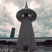
Dense LiDAR SLAM mapping around a real building using my handheld LiDAR SLAM setup.
Unlike the previous 10km vehicle-mounted city mapping test, this session focuses on dense local mapping quality around a single building. I walked around the building exterior and generated a detailed 3D point cloud map using LiDAR SLAM.
What's shown in this video:
Dense 3D mapping around a real building
Handheld LiDAR SLAM while walking around the site
Real-time point cloud generation
Building exterior, sidewalk, road, trees, and surrounding structures captured in 3D
Stable mapping result without noticeable drift issues in this test
Software:
Custom LiDAR SLAM pipeline (C++)
Web-based 3D point cloud viewer (three.js with claude)
Hardware:
LiDAR: Livox Mid-360
Compute: NVIDIA Jetson Orin Nano Super
Frame: Custom 3D-printed handheld mapping rig
Battery: Backpack-mounted battery system
Grip: Handheld tripod-based configuration
This test is focused on dense building-scale mapping rather than long-distance vehicle mapping. The goal was to check how well the SLAM pipeline captures detailed urban structure while walking around a real building.
SJY Robotics — SLAM, Navigation, Multi-Robot Systems
#LiDAR #SLAM #Mid360 #PointCloud #HandheldScanner #MobileMapping #Robotics #3DMapping #Mapping #JetsonOrin
