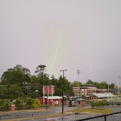
North Carolina Evening Severe Warned Thunderstorm | 07/10/26 | Spindale, NC
WNC Storm Life
0:00 / 0:00
North Carolina Evening Severe Warned Thunderstorm | 07/10/26 | Spindale, NC
131 просмотр · 2 месяца назад
WNC Storm Life
83 подписчика
131 просмотр · 2 месяца назад
Timestamps are below!
On July 10th, 2026 a level 1 marginal risk was issued for all of North and South Carolina, Virginia and Tennessee, which prompted several strong/severe thunderstorms with intense downburst winds. I had decided to go to the foothills/piedmont areas to try to find some thunderstorms, with very little luck as they organized and moved away very quickly. They organized into a line that blasted Charlotte and Gastonia especially hard, with tens of thousands of people without power. However, a second line formed in the far western part of the state, moved through the mountains, and eventually into the foothills, where I was able to capture this storm. This storm had a severe thunderstorm warning and a special weather statement on it. The special weather statement stated 40 mph gusts and pea sized hail, while the severe thunderstorm warning indicated 60 mph gusts and penny sized hail. It formed around the Black Mountain/Fairview area in Buncombe County, and made its way into McDowell/Rutherford Counties. Typically those type of storms become strong/severe when they hit the foothills.
This storm was not producing much lightning, and only when it ramped up did a little bit occur, but it seemed like the main threat in these storms was wind. Hail and lightning were least of concerns. This storm produced a beautiful shelf cloud as it rolled in, and this was the bottom of the line. The rest of the storm expanded further north. It passed very quickly, and only rained for a few minutes. But the wind in this thing was INSANE! Almost knocked me off my feet, but it was in and out quick. I recorded this storm at the White Oaks Plaza south of downtown Spindale. This area is known for frequent thunderstorms as well. As always, thank you for your time and there is more to come!
Quality for this video was modified using CapCut.
Timestamps:
00:00 Video starts with storm rolling in from the west
05:00 Extremely prominent shelf cloud forms
06:30 Wind begins to pick up
08:00 Light rain begins to fall, wind picks up more
11:15 Heavy rain begins, wind begins to taper off
18:00 Rain lets up as storm moves away
